Visualization service of Historical inventory of the IRYDA drillings


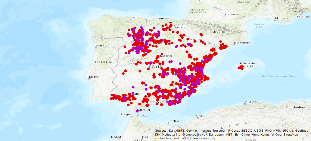
Service of visualization of the historical inventory of the drillings carried out for the research of the different aquifers of Spain, result of the collaboration between the Geological and Mining Institute of Spain (IGME-CSIC), with the National Institute of Reform and Agrarian Development (IRYDA), formerly National Institute of Colonization (INC)
large_thumbnail
service
- Servicio
IGME-CSIC
:
WMS_BD_SONDEOSIRYDA
view
IGME Thesaurus:
GEMET - INSPIRE themes, version 1.0:
 Web Services Specifications:
ISO 19119:
INSPIRE_SpatialDataServicesClassification:
Spatial Scope:
Web Services Specifications:
ISO 19119:
INSPIRE_SpatialDataServicesClassification:
Spatial Scope:
IGME
WATER
Water Points
Borehole
WATER
Water Points
Hydroeology
Hydroeology
lithology
Spain
OGC (Open Geospatial Consortium)
WMS (Web Map Service)
WMS 1.3.0
OGC
WMS
Map access service
Geographic information/model management service
Free:
IRYDA
NC
Free:
EGDI
-18.25,
27.5,
4.5,
43.75
creation: 2019-07-26
On-line availability of IRYDA's Historical Inventory
Geological Survey of Spain (IGME-CSIC)
email:
cartografiadigital@igme.es
Role: point of contact
Geological Survey of Spain (IGME-CSIC)
email:
cartografiadigital@igme.es
Role: custodian
Data Quality
Constraints
LICENCE OF USE: Conditions of public use and dissemination of information for the re-use of IGME data. https://www.igme.es/condiciones-de-uso/
Metadata about metadata
ESPIGMESERVICIOSONDEOSIRYDA20190726
Geological Survey of Spain (IGME-CSIC)
Leticia Vega Martín
Leticia Vega Martín
,
Madrid,
28003,
España
tel: +34 91 349 57 41
email:
l.vega@igme.es
Role: point of contact
2025-05-19