Monthly simulated groundwater levels for Central Luzon, Philippines (1979 to 2089) (NERC Grant NE/S003118/1)

Ensemble of simulated groundwater levels for Central Luzon, Philippines. The simulated time series of data covers the period December 1979 to December 2089 under two Representative Concentration Pathways (RCP2.6 and RCP 8.5). Each ensemble member csv file contains a timeseries of groundwater levels for five locations within the Central Luzon region. The textfile included in the folder shows the coordinates for these locations.
dataset
:
http://data.bgs.ac.uk/id/dataHolding/13607995
English
Geoscientific information
GEMET - INSPIRE themes, version 1.0:
BGS Thesaurus of Geosciences:
Climatology
Simulation
Water management
Droughts
NGDC Deposited Data
Hydrology
Floods
Free:
Free:
NERC_DDC
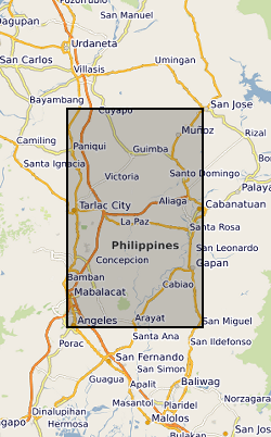
120.5700,
15.1300,
120.9800,
15.7900
PH, PHILIPPINES [id=552000], PHL
creation: 2022-09-30
2020-01-01
-
2022-03-31
British Geological Survey
Enquiries
Environmental Science Centre, Nicker Hill, Keyworth,
NOTTINGHAM,
NG12 5GG,
United Kingdom
tel: 0115 936 3143
email:
enquiries@bgs.ac.uk
Role: distributor
British Geological Survey
Enquiries
Environmental Science Centre, Nicker Hill, Keyworth,
NOTTINGHAM,
NG12 5GG,
United Kingdom
tel: 0115 936 3143
email:
enquiries@bgs.ac.uk
Role: originator
British Geological Survey
Enquiries
email:
not available
Role: distributor
British Geological Survey
Enquiries
email:
not available
Role: point of contact
Data Quality
Regional groundwater models were constructed using MODFLOW and calibrated using a timeseries of groundwater level data. Recharge for the simulation was generated using the VIC hydrological model. VIC was driven by over 50 input parameters, with ERA5 reanalysis climate inputs for the calibration phase and an ensemble of UKCP18 global climate inputs for the simulated future time series. Representative concentration pathways (RCP) 2.6 and 8.5 were selected to generate groundwater levels under less and more severe potential climate futures.
INSPIRE Implementing rules laying down technical arrangements for the interoperability and harmonisation of Geology
Commission Regulation (EU) No 1089/2010 of 23 November 2010 implementing Directive 2007/2/EC of the European Parliament and of the Council as regards interoperability of spatial data sets and services
Constraints
The copyright of materials derived from the British Geological Survey's work is vested in the Natural Environment Research Council [NERC]. No part of this work may be reproduced or transmitted in any form or by any means, or stored in a retrieval system of any nature, without the prior permission of the copyright holder, via the BGS Intellectual Property Rights Manager. Use by customers of information provided by the BGS, is at the customer's own risk. In view of the disparate sources of information at BGS's disposal, including such material donated to BGS, that BGS accepts in good faith as being accurate, the Natural Environment Research Council (NERC) gives no warranty, expressed or implied, as to the quality or accuracy of the information supplied, or to the information's suitability for any use. NERC/BGS accepts no liability whatever in respect of loss, damage, injury or other occurence however caused.
Available under the Open Government Licence subject to the following acknowledgement accompanying the reproduced NERC materials "Contains NERC materials ©NERC [year]"
licenceOGL
Metadata about metadata
eca663a7-381c-51f4-e053-0937940afc2e
British Geological Survey
Environmental Science Centre,Keyworth,
NOTTINGHAM,
NG12 5GG,
United Kingdom
tel: +44 115 936 3100
email:
enquiries@bgs.ac.uk
Role: point of contact
2024-04-24