Probabilistic models of earthquake location and velocity structure beneath New Ollerton, UK

The models are probabilistic inferences of earth structure and earthquake location based around travel times of P and S waves recorded at seismic stations above New Ollerton, Nottinghamshire, UK. For each point in the subsurface, we present many different values of the P- and S-wave velocity which are compatible with the data. Likewise, we present many event locations for each earthquake included in the dataset. These different models represent the posterior probability distribution respectively for the subsurface velocity and earthquake locations.
model
:
http://data.bgs.ac.uk/id/dataHolding/13607991
English
Geoscientific information
GEMET - INSPIRE themes, version 1.0:
BGS Thesaurus of Geosciences:
Induced seismicity
Earthquake magnitude
NGDC Deposited Data
Monte Carlo method
Free:
Free:
NERC_DDC
-1.1000,
53.2000,
-0.9500,
53.2800
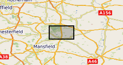
New Ollerton [id=1371420]
creation: 2022-10-28
2013-12-01
-
2014-01-31
University of Leeds
Andy Nowacki
email:
not available
Role: originator
British Geological Survey
Enquiries
email:
not available
Role: distributor
British Geological Survey
Enquiries
email:
not available
Role: point of contact
Data Quality
The suite of models are created by sampling the posterior probability distribution using a Markov chain Monte Carlo approach. The methods are described in the open-access paper below: Roy, C., Nowacki, A., Zhang, X., Curtis, A., Baptie, B., 2021. Accounting for natural uncertainty within monitoring systems for induced seismicity based on earthquake magnitudes. Front. Earth Sci. 9, 634688. https://doi.org/10.3389/feart.2021.634688
INSPIRE Implementing rules laying down technical arrangements for the interoperability and harmonisation of Geology
Commission Regulation (EU) No 1089/2010 of 23 November 2010 implementing Directive 2007/2/EC of the European Parliament and of the Council as regards interoperability of spatial data sets and services
Constraints
The copyright of materials derived from the British Geological Survey's work is vested in the Natural Environment Research Council [NERC]. No part of this work may be reproduced or transmitted in any form or by any means, or stored in a retrieval system of any nature, without the prior permission of the copyright holder, via the BGS Intellectual Property Rights Manager. Use by customers of information provided by the BGS, is at the customer's own risk. In view of the disparate sources of information at BGS's disposal, including such material donated to BGS, that BGS accepts in good faith as being accurate, the Natural Environment Research Council (NERC) gives no warranty, expressed or implied, as to the quality or accuracy of the information supplied, or to the information's suitability for any use. NERC/BGS accepts no liability whatever in respect of loss, damage, injury or other occurence however caused.
Available under the Open Government Licence subject to the following acknowledgement accompanying the reproduced NERC materials "Contains NERC materials ©NERC [year]"
licenceOGL
Metadata about metadata
ec6ade01-2016-0ba2-e053-0937940a5172
British Geological Survey
Environmental Science Centre,Keyworth,
NOTTINGHAM,
NG12 5GG,
United Kingdom
tel: +44 115 936 3100
email:
enquiries@bgs.ac.uk
Role: point of contact
2024-04-24