Polygon inventory of 183 landslides mapped across Langtang Valley, Nepal (NERC Grant NE/L002582/1)

This is a polygon shapefile inventory of 183 coseismic and climate-triggered landslides in the south-western portion of Langtang Valley Nepal. All mapped landslides were those visible in the landscape during the period 2017 – 2018. Landslides were mapped using a combination of field and remote sensing methodologies (see lineage). The inventory includes the landslide locations, perimeters (Length field), areas, types, and whether a given landslide was mapped in the field or remotely. These landslides were mapped for a range of purposes, from conducting landslide susceptibility assessments, to investigating landslide processes and preconditioning.
dataset
:
http://data.bgs.ac.uk/id/dataHolding/13607779
English
Geoscientific information
GEMET - INSPIRE themes, version 1.0:
BGS Thesaurus of Geosciences:
NGDC Deposited Data
Landslides
Free:
Free:
NERC_DDC
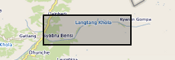
85.3400,
28.1400,
85.6000,
28.2300
NEPAL [id=497000], NP, NPL
creation: 2021-06-21
2018-10-01
-
2020-10-01
text table
University of Plymouth
Joshua Jones
Plymouth
email:
not available
Role: originator
British Geological Survey
Enquiries
email:
not available
Role: distributor
British Geological Survey
Enquiries
email:
not available
Role: point of contact
Data Quality
Landslides were mapped using a combination of field mapping and remote sensing. Field mapped landslides were identified during walk-over surveys conducted in October 2018. The locations and geometries of these landslides were recorded using a hand-held Garmin GPS unit and a TruPulse laser range finder. The exact geometries of these field-observed landslides were then corroborated using WorldView/GeoEye Satellite imagery from 2017. Furthermore, as not all landslides were accessible in the field, additional landslides in the landscape were mapped from the WorldView/GeoEye imagery alone, where all visible landslides in the imagery were delineated as polygons that included the source, runout and deposition zones of each landslide. The general type of each landslide was also classified according to the terminology of Varnes (1958).
INSPIRE Implementing rules laying down technical arrangements for the interoperability and harmonisation of Geology
Commission Regulation (EU) No 1089/2010 of 23 November 2010 implementing Directive 2007/2/EC of the European Parliament and of the Council as regards interoperability of spatial data sets and services
Constraints
The copyright of materials derived from the British Geological Survey's work is vested in the Natural Environment Research Council [NERC]. No part of this work may be reproduced or transmitted in any form or by any means, or stored in a retrieval system of any nature, without the prior permission of the copyright holder, via the BGS Intellectual Property Rights Manager. Use by customers of information provided by the BGS, is at the customer's own risk. In view of the disparate sources of information at BGS's disposal, including such material donated to BGS, that BGS accepts in good faith as being accurate, the Natural Environment Research Council (NERC) gives no warranty, expressed or implied, as to the quality or accuracy of the information supplied, or to the information's suitability for any use. NERC/BGS accepts no liability whatever in respect of loss, damage, injury or other occurence however caused.
Available under the Open Government Licence subject to the following acknowledgement accompanying the reproduced NERC materials "Contains NERC materials ©NERC [year]"
licenceOGL
Metadata about metadata
c610b2f9-a983-4219-e054-002128a47908
British Geological Survey
Environmental Science Centre,Keyworth,
NOTTINGHAM,
NG12 5GG,
United Kingdom
tel: +44 115 936 3100
email:
enquiries@bgs.ac.uk
Role: point of contact
2024-04-24