Geochemical data for giant piston core MD04-2832 (Loch Sunart, Scotland) (NERC Grant NE/L501852/1)

Geochemical data for the upper 300cm of giant piston core MD04-2832. Core MD04-2832 was collected from the middle basin of Loch Sunart a fjord on the west coast of Scotland from the research vessel Marion Dufresne on the 15th of June 2004. This data resource includes five data sheets: (1) Geochemical data, (2) Bulk radiocarbon, (3) ICP-MS, (4) FRUITS and (5) Age Model. 1. Geochemical data sheet includes Bulk elemental data (Organic Carbon, Nitrogen, C/N ratio, N/C ratio), Isotopic data (δ13C and ẟ15N), Biomarker data (Alkanes, Fatty Acids, GDGT's) and thermosgravimetric data (% labile, recalcitrant and refractory organic matter). 2. Bulk Radiocarbon data sheet includes bulk radiocarbon data for ten sediment samples presented as % modern, 14C Age (years BP), ẟ14C and Δ14C. 3. ICP-MS data sheet includes metal data associated with mining activities within the fjords catchment. Data includes Zinc (Zn), Lead (Pb), Copper (Cu), Barium (Ba), Aluminium (Al) and elemental ratios of these metal normalized with Al concentrations. 4. The FRUITS data sheet contains the outputs from the FRUITS Bayesian isotopic mixing model (Fernandes et al., 2014) used to constrain the source (terrestrial vs marine) of the organic carbon found at site MD04-2832. The model used bulk elemental ratios (N/C), Isotopic (δ13C and ẟ15N) and biomarker data (GDGT - BIT Index) to calculate the terrestrial and marine OC fraction from each downcore sample. 5. The Age Model datasheet contains the age model produced by the BACON software package (Blaauw and Christen, 2011). The age model was developed with a combination of shell/foraminifera radiocarbon dates and radiometric dating (210Pb and 137Cs). Further details on the data can be found in Smeaton, C., Cui, X., Bianchi, T.S., Cage, A.G., Howe J.A., Austin, W.E.N., (2021), The evolution of a coastal carbon store over the last millennium, Quaternary Science Reviews.
dataset
:
http://data.bgs.ac.uk/id/dataHolding/13607776
English
Geoscientific information
GEMET - INSPIRE themes, version 1.0:
BGS Thesaurus of Geosciences:
Holocene
Mining
Biomarkers
NGDC Deposited Data
Carbon
Carbon isotopes
Sea floor
Alkanes
Fjords
Isotopes
Mass spectroscopy
Metals
Sediments
Free:
Free:
NERC_DDC
-5.8700,
56.6600,
-5.8600,
56.6700
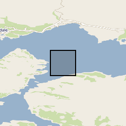
Loch Sunart [id=1346231], SCOTLAND [id=140000], SCT
creation: 2021-06-27
2004-06-15
-
2020-01-27
text table
University of St Andrews
Craig Smeaton
School of Geography & Sustainable Development Irvine Building, North Street,
St Andrews,
KY16 9AL
email:
not available
Role: originator
British Geological Survey
Enquiries
email:
not available
Role: distributor
British Geological Survey
Enquiries
email:
not available
Role: point of contact
Data Quality
Core MD04-2832 was collected using a giant piston corer from the research vessel Marion Dufresne on the 15th of June 2004. The core was collected from the middle basin of Loch Sunart (56.669833, -5.868667) at a water depth of 52.1m. Samples where stored at 4°C prior to sub-sampling and analysis. The cores were split and volumetric subsamples collected at 5cm intervals. The samples were freeze-dried and milled prior to analysis. The bulk and inorganic geochemical analysis was carried out at the University of St Andrews, while organic geochemistry analysis was undertaken and the University of Florida. Full methodological approaches can be found in the supporting documentation (.rts file) within this data resource. Further methodological details can be found in Smeaton, et al.,(2021), The evolution of a coastal carbon store over the last millennium, Quaternary Science Reviews.
INSPIRE Implementing rules laying down technical arrangements for the interoperability and harmonisation of Geology
Commission Regulation (EU) No 1089/2010 of 23 November 2010 implementing Directive 2007/2/EC of the European Parliament and of the Council as regards interoperability of spatial data sets and services
Constraints
The copyright of materials derived from the British Geological Survey's work is vested in the Natural Environment Research Council [NERC]. No part of this work may be reproduced or transmitted in any form or by any means, or stored in a retrieval system of any nature, without the prior permission of the copyright holder, via the BGS Intellectual Property Rights Manager. Use by customers of information provided by the BGS, is at the customer's own risk. In view of the disparate sources of information at BGS's disposal, including such material donated to BGS, that BGS accepts in good faith as being accurate, the Natural Environment Research Council (NERC) gives no warranty, expressed or implied, as to the quality or accuracy of the information supplied, or to the information's suitability for any use. NERC/BGS accepts no liability whatever in respect of loss, damage, injury or other occurence however caused.
Available under the Open Government Licence subject to the following acknowledgement accompanying the reproduced NERC materials "Contains NERC materials ©NERC [year]"
licenceOGL
Metadata about metadata
c5fae36b-4bab-2e9b-e054-002128a47908
British Geological Survey
Environmental Science Centre,Keyworth,
NOTTINGHAM,
NG12 5GG,
United Kingdom
tel: +44 115 936 3100
email:
enquiries@bgs.ac.uk
Role: point of contact
2024-04-24