Visualisation Service (WMS) GEODE - Continuous digital geological mapping at scale 1:50.000


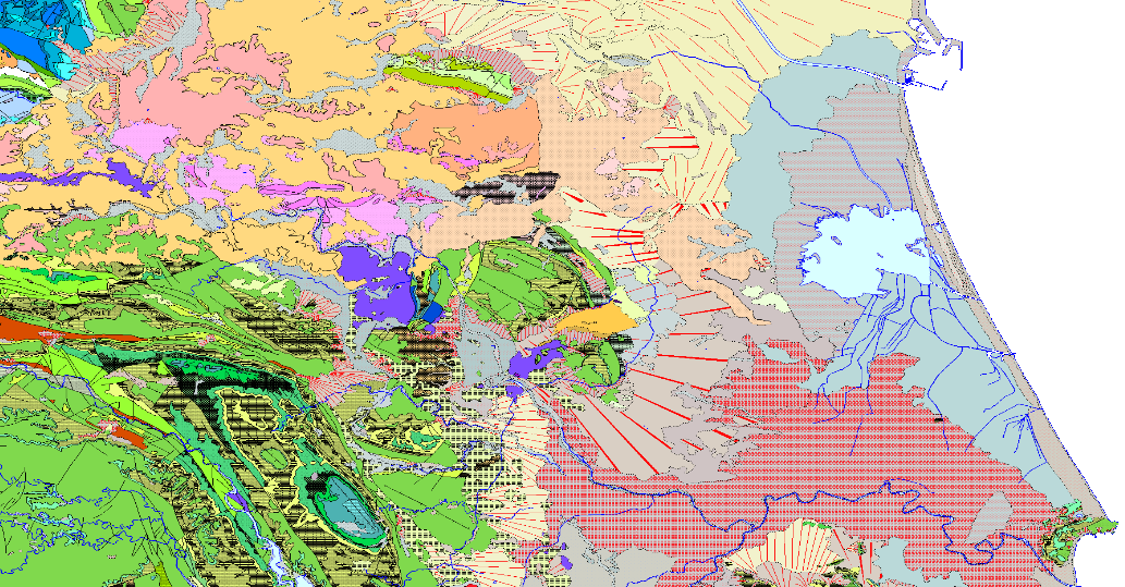
Visualisation Service (WMS) of the geological map which represents the result of the cartographic homogenisation of the MAGNA geological map series (National Geological Cartography at a scale of 1:50.000). Series that integrates 1143 maps. As a consequence of the long process involved in the historical execution of this series, there are differences between its initial and final phases, in terms of criteria for assigning geological units, level of detail, continuity of geological units and structures at the edges of sheets, coding and symbologies. With the aim of correcting these problems, the GEODE PLAN was initiated in 2004, which constitutes the institutional support for the generation of a continuous digital geological map at a scale of 1:50,000. The PLAN integrates 19 Regional Projects linked to their corresponding geological zones. Its fundamental objectives are threefold: - To provide cartographic continuity to the geological sheets of the MAGNA series within each region. - To generate a unified legend of geological units for each region. - To adapt the geological coverage to a uniform topographic base, generated specifically for the GEODE PLAN from the national topographic map 1:25000 of the IGN.
large_thumbnail
service
- Servicio
view
GEMET - INSPIRE themes, version 1.0:
 Spatial scope:
IGME Thesaurus:
ISO 19119:
Web Services Specifications:
ISO - 19119 geographic services taxonomy:
INSPIRE_SpatialDataServicesClassification:
Spatial scope:
IGME Thesaurus:
ISO 19119:
Web Services Specifications:
ISO - 19119 geographic services taxonomy:
INSPIRE_SpatialDataServicesClassification:
Cartography
Geology
Spain
OGC (Open Geospatial Consortium)
WMS (Web Map Service)
WMS 1.3.0
OGC
WMS
infoMapAccessService
Map access service
Geographic modelling/information management service
Free:
IGME
Free:
IDEE
Free:
EGDI
Free:
WMS
-18.168,
27.584,
4.482,
43.834
creation: 2019-05-14, publication: 2019-05-14
Instituto Geológico y Minero de España (IGME-CSIC)
email:
cartografiadigital@igme.es
Role: point of contact
Instituto Geológico y Minero de España (IGME-CSIC)
email:
cartografiadigital@igme.es
Role: custodian
Data Quality
Reglamento (UE) n o 1089/2010 de la Comisión de 23 de noviembre de 2010 por el que se aplica la Directiva 2007/2/CE del Parlamento Europeo y del Consejo en lo que se refiere a la interoperabilidad de los conjuntos y los servicios de datos espaciales
REGLAMENTO (CE) No 1205/2008 DE LA COMISIÓN de 3 de diciembre de 2008 por el que se ejecuta la Directiva 2007/2/CE del Parlamento Europeo y del Consejo en lo que se refiere a los metadatos
Constraints
LICENCE OF USE: Conditions of public use and dissemination of information for the re-use of IGME data http://www.igme.es/Ayuda/CondiUso.htm
Metadata about metadata
ESPIGMESERVICIOGEODE5020190513
Instituto Geológico y Minero de España (IGME-CSIC)
Leticia Vega Martín
Leticia Vega Martín
C/Ríos Rosas, 23,
Madrid,
28003,
España
tel: +34 91 349 57 41
email:
l.vega@igme.es
Role: point of contact
2025-05-09