BGS Geology - 625k (DiGMapGB-625) 2008

Data identifying landscape areas (shown as polygons) attributed with geological names. The scale of the data is 1:625 000 providing a simplified interpretation of the geology and may be used as a guide at a regional or national level, but should not be relied on for local geology. Onshore coverage is provided for all of England, Wales, Scotland, the Isle of Man and Northern Ireland. Data are supplied as four themes: bedrock, superficial deposits, dykes and linear features (faults). Bedrock geology describes the main mass of solid rocks forming the earth's crust. Bedrock is present everywhere, whether exposed at surface in outcrops or concealed beneath superficial deposits or water bodies. Geological names are based on the lithostratigraphic or lithodemic hierarchy of the rocks. The lithostratigraphic scheme arranges rock bodies into units based on rock-type and geological time of formation. Where rock-types do not fit into the lithostratigraphic scheme, for example intrusive, deformed rocks subjected to heat and pressure resulting in new or changed rock types; then their classification is based on their rock-type or lithological composition. This assesses visible features such as texture, structure, mineralogy. Superficial deposits are younger geological deposits formed during the most recent geological time; the Quaternary. These deposits rest on older rocks or deposits referred to as bedrock. The superficial deposits theme defines landscape areas (shown as polygons) attributed with a geological name and their deposit-type or lithological composition. The dykes theme defines small, narrow areas (shown as polygons) of a specific type of bedrock geology; that is igneous rocks which have been intruded into the landscape at a later date than the surrounding bedrock. They are presented as an optional, separate theme in order to provide additional clarity of the bedrock theme. The bedrock and dykes themes are designed to be used together. Linear features data (shown as polylines) represents geological faults at the ground or bedrock surface (beneath superficial deposits). Geological faults occur where a body of bedrock has been fractured and displaced by large scale processes affecting the earth's crust (tectonic forces). The faults theme defines geological faults (shown as polylines) at the ground or bedrock surface (beneath superficial deposits). All four data themes are available in vector format (containing the geometry of each feature linked to a database record describing their attributes) as ESRI shapefiles and are delivered free of charge under the terms of the Open Government Licence.
dataset
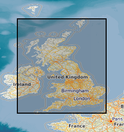
Digital Geological Map Data of Great Britain - 625k (DiGMapGB-625)
- Web Map Context file to access the BGS 1:625k Bedrock and Superficial geology WMS
BGS Bedrock and Superficial geology
- OGC Web Map Service (WMS) providing access to this dataset through a number of representations (layers)
BGS Bedrock and Superficial geology
- OGC Web Feature Service (WFS) providing access to this dataset through a number of representations (feature types)
digmap625
- KML (raster) resource for DigMapGB625, using WMS as source of data
:
http://data.bgs.ac.uk/id/dataHolding/13480426
English
Geoscientific information
GEMET - INSPIRE themes, version 1.0:
BGS Thesaurus of Geosciences:
Data
Digital maps
Scottish SDI
GIS
Maps
UK Location (INSPIRE)
Geology
Free:
NERC_DDC
-8.6500,
49.7700,
1.7800,
60.8600
GB, UK [id=139300], UKM
creation: 2008
unknown
-
before
vector
British Geological Survey
Enquiries
Environmental Science Centre, Nicker Hill, Keyworth,
NOTTINGHAM,
NG12 5GG,
United Kingdom
tel: 0115 936 3143
email:
enquiries@bgs.ac.uk
Role: distributor
British Geological Survey
Enquiries
Environmental Science Centre, Nicker Hill, Keyworth,
NOTTINGHAM,
NG12 5GG,
United Kingdom
tel: 0115 936 3143
email:
enquiries@bgs.ac.uk
Role: point of contact
Data Quality
A new 1:625 000 scale (5th edition) printed geological map of the United Kingdom, published in 2007, was prepared digitally and these data were then used to create the replacement DiGMapGB-625 Bedrock Version 5. The 1:625 000 Bedrock data were created from two main sources. The geology for England & Wales, Scotland and the Isle of Man is generalised directly from the 1:50 000 scale DiGMapGB-50 V3 data released in 2006 with ongoing revisions through to 2007 incorporating selective interpretations from new 50k maps, anticipating their release as V5 tiles in 2008. The data for Northern Ireland were derived by minor simplification from the 1:250 000 scale geological map of Northern Ireland, published in 2007. Holes in the 50k data were filled using information from other sources. The version 5 data of the 1: 625 000 dykes data was created primarily from the 1:50 000 scale Digital Geological Map of Great Britain (DiGMapGB-50) version 3 dataset (released in 2006) by generalisation involving cartographic selection, modification, simplification or exaggeration and matches that shown on the BGS poster maps of the UK (North and South) published in 2008. The attributes and nomenclature used follow those on the printed maps. The version 5 data of the 1: 625 000 linear features data was created primarily from the 1:50 000 scale Digital Geological Map of Great Britain (DiGMapGB-50) version 3 dataset (released in 2006) by generalisation involving cartographic selection, modification, simplification or exaggeration and matches that shown on the BGS poster maps of the UK (North and South) published in 2008. The attributes and nomenclature used follow those on the printed maps. The linear features were fitted to a relevant topographic base at the time of production. The 1:625 000 Superficial data were compiled from two main sources: the latest available 1:50 000 data (together with other information used to fill in the ‘holes’) and the 1:250 000 published Quaternary map of Northern Ireland.
Equivalent Scale:
1:
625000
INSPIRE Implementing rules laying down technical arrangements for the interoperability and harmonisation of Geology
Commission Regulation (EU) No 1089/2010 of 23 November 2010 implementing Directive 2007/2/EC of the European Parliament and of the Council as regards interoperability of spatial data sets and services
Constraints
The copyright of materials derived from the British Geological Survey's work is vested in the Natural Environment Research Council [NERC]. No part of this work may be reproduced or transmitted in any form or by any means, or stored in a retrieval system of any nature, without the prior permission of the copyright holder, via the BGS Intellectual Property Rights Manager. Use by customers of information provided by the BGS, is at the customer's own risk. In view of the disparate sources of information at BGS's disposal, including such material donated to BGS, that BGS accepts in good faith as being accurate, the Natural Environment Research Council (NERC) gives no warranty, expressed or implied, as to the quality or accuracy of the information supplied, or to the information's suitability for any use. NERC/BGS accepts no liability whatever in respect of loss, damage, injury or other occurence however caused.
Available under the Open Government Licence subject to the following acknowledgement accompanying the reproduced NERC materials "Contains NERC materials ©NERC [year]"
licenceOGL
Metadata about metadata
9df8df52-d788-37a8-e044-0003ba9b0d98
British Geological Survey
Environmental Science Centre,Keyworth,
NOTTINGHAM,
NG12 5GG,
United Kingdom
tel: +44 115 936 3100
email:
enquiries@bgs.ac.uk
Role: point of contact
2024-04-17