Coastline migration from field-monitoring

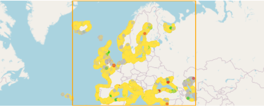
Pan-European coastline-migration map at zoomable scale. The map is collated and harmonized from field-monitoring data and aerial photography provided by partners of EMODnet Geology. Where no such coastline-migration data were available, information from the EUROSION project is provided. For remaining gaps, please consult the coastline-migration map based on satellite data. The main attributes denote degree of landward (by erosion or submergence) or seaward (by accretion or emergence) change. In the visualization provided, three classes are distinguished: landward migration, stable coastline, seaward migration. The criterion for stable coastlines is ≤0.5 meter net change per year over a 10-year period. The current version was finalized in January 2021.
dataset
EMODnetCoastalMigration
- Coastline migration determined from field-monitoring data and aerial photographs
https://emodnet.ec.europa.eu/geonetwork/srv/eng/catalog.search#/metadata/6f58fab303bb03214b47c2173156182a7c86c0e2
English
Geoscientific information
GEMET - INSPIRE themes, version 1.0:
 Spatial scope:
EGDI Keyword Thesaurus:
European Geoscience Registry - Projects:
Spatial scope:
EGDI Keyword Thesaurus:
European Geoscience Registry - Projects:
Free:
coastal migration
-31.5,
27.5,
69,
82
publication: 2021-02-04
2021-02-04
vector
Project leader
Princetonlaan 6,
Utrecht,
3584 CB,
Netherlands
tel: 0888664300
email:
support@geologischedienst.nl
Role: custodian
Data Quality
Coastline migration determined from field-monitoring data and aerial photographs - Combined from national datasets.
Constraints
Metadata about metadata
601c340f-1228-41f2-ab62-11c90a010833
Reinder Reindersma
Princetonlaan 6,
Utrecht,
3584 CB,
Netherlands
tel: 0888664300
email:
reinder.reindersma@tno.nl
Role: point of contact
2026-05-27