Geophysical measurements


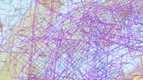
Map application displays layers, thematically divided according to the geophysical methods used for the data acquisition. The map application contains the geophysical measurements paid by the Czech state, carried out mainly by former company Geofyzika Brno. Application displays the following map layers: seismic (2D reflection seismic and well shoots), vertical electric sounding (polygons, lines, points), gravimetry (map ot the Bauguers anomalies) and localization of the geophysical surveys on the territory of the Czech Republic (both regional and local).
application
https://registry.geology.cz/id/GFY-MERENI-SDE-APL
Map
ISO 19119:
GEMET - INSPIRE themes, version 1.0:
 CGS Geoscientific themes:
Spatial scope:
GEMET - Concepts, version 3.1:
CGS Geoscientific themes:
Spatial scope:
GEMET - Concepts, version 3.1:
Free:
vertical electric sounding, VES
reflection seismic profile
check-shooting
geophysical survey
gravimetry
CzechGeo
EGDI
11.99,
48.253,
18.91,
51.247
creation: 2018-02, publication: 2018-05-01, revision: 2018-12-19
CzechGeo / EPOS Project, data disclosure
Ing. Martin Paleček
Leitnerova 204/22,
Brno,
602 00,
Česká republika
tel: +420543429261
email:
martin.palecek@geology.cz
Role: processor
RNDr. Roman Kujal, Ph.D.
Kostelní 364/26,
Praha 7,
170 00,
Česká republika
tel: +420234742118
email:
roman.kujal@geology.cz
Role: point of contact
Klárov 131/3,
Praha 1,
118 00,
Česká republika
tel: +420257089411
email:
metadata@geology.cz
Role: custodian
Data Quality
Constraints
Metadata about metadata
5aba4dc2-b50c-4112-bf47-1c450a010852
Mgr. Olga Moravcová, Ph.D.
Klárov 131/3,
Praha 1,
118 00,
Česká republika
tel: +420257089445
email:
olga.moravcova@geology.cz
Role: point of contact
2026-02-27