Abandoned mine lands


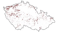
WMS Service displays key information on areas where underground mining or mineral exploration was undertaken in the past. It provides warnings about areas where subsidence or other hazards may occur due to the presence of underground spaces.
service
- služba
https://registry.geology.cz/id/VDC-PODDOL-SDE-WMS
WMS
1.3.0
ISO 19119:
GEMET - INSPIRE themes, version 1.0:
 Spatial scope:
CGS Geoscientific themes:
European Geoscience Registry - Projects:
Spatial scope:
CGS Geoscientific themes:
European Geoscience Registry - Projects:
11.686,
48.187,
19.051,
51.496
creation: 2002
Ing. Martin Paleček
Leitnerova 204/22,
Brno,
602 00,
Česká republika
tel: +420543429261
email:
martin.palecek@geology.cz
Role: point of contact
Klárov 131/3,
Praha 1,
118 00,
Česká republika
tel: +420257089411
email:
metadata@geology.cz
Role: custodian
Data Quality
Constraints
Metadata about metadata
53da5902-51d0-4795-b5af-2f8c0a010817
Mgr. Pavla Kramolišová
Kostelní 364/26,
Praha 7,
170 00,
Česká republika
tel: +420 234 742 161
email:
pavla.kramolisova@geology.cz
Role: point of contact
2026-05-20