INSPIRE: EMODnet-DE - Offshore Geology - Quaternary (EMODnet-DE Quaternary)


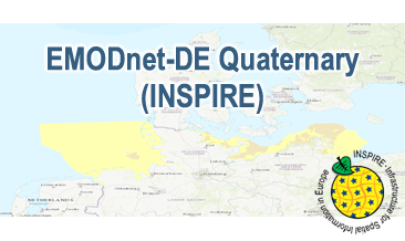
Compilation of the European Quaternary marine geology (section of Germany). The map consists of data at highest available spatial resolution, map scale („multi-resolution“-concept) and data completeness vary depending on the project partner (as of 2019 April). Project partners are the national geological services of the participating countries. According to the Data Specification on Geology (D2.8.II.4_v3.0) the content of the geological map is stored in a INSPIRE-compliant GML file: EMODnet-DE_Quaternary_GeologicUnit.gml contains the geologic units. The GML file together with a Readme.txt file are provided in ZIP format (EMODnet-DE_Quaternary-INSPIRE.zip). The Readme.text file (German/English) contains detailed information on the GML file content. Data transformation was proceeded by using the INSPIRE Solution Pack for FME according to the INSPIRE requirements.
dataset
- Geologie
EMODnet-DE Quaternary (INSPIRE) (INSPIRE-GML)
- EMODnet-DE Quaternary (INSPIRE) im Format INSPIRE-GML
:
https://registry.gdi-de.org/id/de.bund.bgr.csw/e2b828ef-898f-8664-1a6b-97e53d04328d
English
Geoscientific information
GEMET - INSPIRE themes, version 1.0:
GEMET - Themes, version 4.1.4:
Spatial scope:
Geologie
Geology
clay
marine geology
marine sediment
sand
sediment
silt
peat
National
Free:
Deutschland
Germany
Free:
Stratigraphie
inspireidentifiziert
opendata
EGDI
GeolDG
3.30,
53.10,
14.75,
56.00
publication: 2020-09-23, revision: 2021-01-13
vector
Bundesanstalt für Geowissenschaften und Rohstoffe (BGR)
Stilleweg 2,
Hannover,
30655,
DE
email:
geologie.daten@bgr.de
Role: point of contact
Data Quality
The EMODnet-DE Quaternary (INSPIRE) GML file is based on the spatial dataset of BGR EMODnet – Offshore Geology – Quaternary transformed according to INSPIRE.
INSPIRE Data Specification on Geology - Technical Guidelines
VERORDNUNG (EG) Nr. 1089/2010 DER KOMMISSION vom 23. November 2010 zur Durchführung der Richtlinie 2007/2/EG des Europäischen Parlaments und des Rates hinsichtlich der Interoperabilität von Geodatensätzen und -diensten
Constraints
General Terms and Conditions, s. https://www.bgr.bund.de/agb_en
Dieser Datensatz kann gemäß der "Nutzungsbestimmungen für die Bereitstellung von Geodaten des Bundes" (https://sg.geodatenzentrum.de/web_public/gdz/lizenz/geonutzv.pdf) genutzt werden.
{"id": "geonutz/20130319", "name": "Nutzungsbestimmungen für die Bereitstellung von Geodaten des Bundes", "url": "https://sg.geodatenzentrum.de/web_public/gdz/lizenz/geonutzv.pdf", "quelle": "Quelle: Bundesanstalt für Geowissenschaften und Rohstoffe (BGR)"}
Metadata about metadata
068f3d24-4653-4cb0-938e-5c51c25c5e69
Bundesanstalt für Geowissenschaften und Rohstoffe (BGR)
,
DEU
email:
geodatenmanagement@bgr.de
Role: point of contact
2024-03-04