Corinth Rift, Greece Fault Location and Activity Rate data (NERC Grant NE/R016550/1)

The data are derived from interpretation of seismic reflection profiles within the offshore Corinth Rift, Greece (the Gulf of Corinth) integrated with IODP scientific ocean drilling borehole data from IODP Expedition 381 (McNeill et al., 2019a, 2019b). The data include rift fault coordinate (location, geometry) information and slip rate and extension rate information for the major faults. Seismic reflection data were published in Taylor et al. (2011) and in Nixon et al. (2016). Preliminary fault interpretations and rate data, prior to IODP drilling, were published in Nixon et al. (2016). Details of datasets: The data can be viewed in GIS software (ArcGIS, QGIS) or the Excel and .dbf files can be used for viewing of rate data and import of fault coordinates into other software. The 4 folders are for different time periods with shape files for the N-Dipping and S-Dipping Faults in the offshore Corinth Rift and respective slip and extension (horizontal) rates. The shapefiles are digitised fault traces for the basement offsetting faults, picked from the Multichannel Seismic Data collected by the R/V Maurice Ewing. Fault traces are segmented and each segment has an average throw (vertical) rate (Tavg) in mm/yr. The rates for the segments are averages based on measurements at the ends of each segment. The major fault trace segments also have slip-rates (slip_rate) and extension-rates (ext_rate or extension_) in mm/yr. All rates as well as the names for major faults can be located in the attribute table of the shape files along with X- and Y-coordinates. The coordinate system is WGS84 UTM Zone 34N. The shape files can be loaded into a GIS (ArcGIS, QGIS etc.) allowing mapping and visualization of the fault traces and their activity rates. In addition, the attribute tables are .dbf files found within each folder. These have also been provided as .xlsx (Excel) files which include the fault coordinate information, and slip rates and extension rates along the major faults. References McNeill, L.C., Shillington, D.J., Carter, G.D.O., and the Expedition 381 Participants, 2019a. Corinth Active Rift Development. Proceedings of the International Ocean Discovery Program, 381: College Station, TX (International Ocean Discovery Program). McNeill, L.C., Shillington, D.J., et al., 2019b, High-resolution record reveals climate-driven environmental and sedimentary changes in an active rift, Scientific Reports, 9, 3116. Nixon, C.W., McNeill, L.C., Bull, J.M., Bell, R.E., Gawthorpe, R.L., Henstock, T.J., Christodoulou, D., Ford, M., Taylor, B., Sakellariou, S. et al., 2016. Rapid spatiotemporal variations in rift structure during development of the Corinth Rift, central Greece. Tectonics, 35, 1225–1248. Taylor, B., J. R. Weiss, A. M. Goodliffe, M. Sachpazi, M. Laigle, and A. Hirn (2011), The structures, stratigraphy and evolution of the Gulf of Corinth Rift, Greece, Geophys. J. Int., 185(3), 1189–1219.
dataset
:
http://data.bgs.ac.uk/id/dataHolding/13608098
English
Geoscientific information
GEMET - INSPIRE themes, version 1.0:
BGS Thesaurus of Geosciences:
Faulting
Extension faults
NGDC Deposited Data
Rift faults
Free:
Free:
NERC_DDC
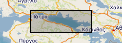
21.7600,
37.9300,
23.2100,
38.4400
GULF OF CORINTH [id=356905]
creation: 2023-08-09
2017-09-07
-
2023-08-01
vector
University of Southampton
Lisa McNeill
National Oceanography Centre, European Way,
Southampton,
SO14 3ZH,
United Kingdom
email:
not available
Role: originator
University of Bergen
Casey Nixon
PO BOX 7803,
Bergen,
55020,
Norway
email:
not available
Role: originator
British Geological Survey
Enquiries
email:
not available
Role: distributor
British Geological Survey
Enquiries
email:
not available
Role: point of contact
Data Quality
Seismic data were used to interpret the locations of rift faults and seismic stratigraphic horizons (see also Nixon et al., 2016), using Petrel seismic interpretation software. The ages of key stratigraphic horizons were derived from borehole cores collected during IODP Expedition 381. A number of dating methods were used on core samples (biostratigraphy, magnetostratigraphy, tephrastratigraphy, correlation of alternating marine and isolated stratigraphic units with Quaternary sea level fluctutations). Borehole data were used to calibrate velocity data to convert time to depth in the seismic data and hence calculate fault offsets. Horizon ages (from borehole data) were used to calculate throw, slip and extension rates for the major faults. Fault locations, coordinates and geometries were exported into ArcGIS/QGIS. Shape files and rate data were extracted for the faults.
INSPIRE Implementing rules laying down technical arrangements for the interoperability and harmonisation of Geology
Commission Regulation (EU) No 1089/2010 of 23 November 2010 implementing Directive 2007/2/EC of the European Parliament and of the Council as regards interoperability of spatial data sets and services
Constraints
The copyright of materials derived from the British Geological Survey's work is vested in the Natural Environment Research Council [NERC]. No part of this work may be reproduced or transmitted in any form or by any means, or stored in a retrieval system of any nature, without the prior permission of the copyright holder, via the BGS Intellectual Property Rights Manager. Use by customers of information provided by the BGS, is at the customer's own risk. In view of the disparate sources of information at BGS's disposal, including such material donated to BGS, that BGS accepts in good faith as being accurate, the Natural Environment Research Council (NERC) gives no warranty, expressed or implied, as to the quality or accuracy of the information supplied, or to the information's suitability for any use. NERC/BGS accepts no liability whatever in respect of loss, damage, injury or other occurence however caused.
There are no restrictions on the use that may be made of the dataset, although an appropriate copyright acknowledgement must be made when any part of the dataset is reproduced. Either no third party data / information is contained in the dataset or BGS has secured written permission from the owner of any third party data / information contained in the dataset to make the dataset freely available without any use constraints - inclusion of any third party data / information will affect the copyright acknowledgement that needs to be made.
licenceOGL
Metadata about metadata
02a6ff69-37cc-42fb-e063-0937940ab682
British Geological Survey
Environmental Science Centre,Keyworth,
NOTTINGHAM,
NG12 5GG,
United Kingdom
tel: +44 115 936 3100
email:
enquiries@bgs.ac.uk
Role: point of contact
2024-04-24