Ship data from Tasman and Coral Seas 2019 (NERC Grant NE/S01067X/1)

These data are derived from a voyage on Australia’s R/V Investigator, IN2019_v04, ‘Hotspot dynamics in the Coral Sea: connections between the Australian plate and the deep Earth’. The voyage surveyed the Tasmantid and Lord Howe Seamounts in the Tasman and Coral Seas, together with the Louisiade Plateau in the Coral Sea, sailing from Cairns on 7 Aug 2019 and arriving in Brisbane on 3 Sep 2019. The voyage summary is available at https://www.marine.csiro.au/data/reporting/get_file.cfm?eov_pub_id=1443. This directory includes the ship data, in some cases with initial onshore processing done by CSIRO technical staff (e.g., the underway data). More details are available in the README file.
dataset
:
http://data.bgs.ac.uk/id/dataHolding/13608090
English
Geoscientific information
GEMET - INSPIRE themes, version 1.0:
BGS Thesaurus of Geosciences:
Bathymetry
Gravity
Rock samples
NGDC Deposited Data
Magnetic data
Geochemistry
Seamounts
X ray fluorescence spectroscopy
Free:
Free:
NERC_DDC
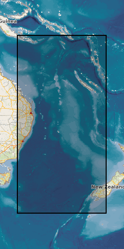
150.0000,
-50.0000,
170.0000,
-10.0000
CORAL SEA [id=2001359], TASMAN SEA [id=2001476]
creation: 2023-06-23
2019-08-07
-
2022-06-15
vector
University of Edinburgh
Lara Kalnins
The King’s Buildings,
Edinburgh,
EH9 3FE
email:
not available
Role: originator
British Geological Survey
Enquiries
email:
not available
Role: distributor
British Geological Survey
Enquiries
email:
not available
Role: point of contact
Data Quality
Primary ship data collected include multibeam echosounder bathymetry data, dredge samples, magnetic data, gravity data, and sub-bottom profiler data, together with a suite of underway measurements. Additional routine measurements not directly relevant to the NERC-funded project associated with this voyage (e.g., current data, sea surface temperature data, radon data) as well as data from piggyback projects (e.g., seabird data) are not included here, but may be available from CSIRO.
INSPIRE Implementing rules laying down technical arrangements for the interoperability and harmonisation of Geology
Commission Regulation (EU) No 1089/2010 of 23 November 2010 implementing Directive 2007/2/EC of the European Parliament and of the Council as regards interoperability of spatial data sets and services
Constraints
The copyright of materials derived from the British Geological Survey's work is vested in the Natural Environment Research Council [NERC]. No part of this work may be reproduced or transmitted in any form or by any means, or stored in a retrieval system of any nature, without the prior permission of the copyright holder, via the BGS Intellectual Property Rights Manager. Use by customers of information provided by the BGS, is at the customer's own risk. In view of the disparate sources of information at BGS's disposal, including such material donated to BGS, that BGS accepts in good faith as being accurate, the Natural Environment Research Council (NERC) gives no warranty, expressed or implied, as to the quality or accuracy of the information supplied, or to the information's suitability for any use. NERC/BGS accepts no liability whatever in respect of loss, damage, injury or other occurence however caused.
There are no restrictions on the use that may be made of the dataset, although an appropriate copyright acknowledgement must be made when any part of the dataset is reproduced. Either no third party data / information is contained in the dataset or BGS has secured written permission from the owner of any third party data / information contained in the dataset to make the dataset freely available without any use constraints - inclusion of any third party data / information will affect the copyright acknowledgement that needs to be made.
The dataset is made freely available for access, e.g. via the Internet. Either no third party data / information is contained in the dataset or BGS has secured written permission from the owner(s) of any third party data / information contained in the dataset to make the dataset freely accessible.
Metadata about metadata
00d7f66c-6296-23b0-e063-0937940aa575
British Geological Survey
Environmental Science Centre,Keyworth,
NOTTINGHAM,
NG12 5GG,
United Kingdom
tel: +44 115 936 3100
email:
enquiries@bgs.ac.uk
Role: point of contact
2024-04-24