Uturuncu Volcano GPS data from the 2018 and 2022 campaigns (NERC Grant NE/S008845/1)

RINEX files of GPS observations obtained in the Uturuncu volcano and surroundings (Altiplano-Puna Deformation Anomaly) during the November 2018 and November 2022 campaigns. In the 2018 and 2022 campaigns, 8 and 10 GPS stations have been installed respectively to help constrain the temporal deformation at Uturuncu volcano. The data contains the GNSS observations made in the 2018 campaign at the stations of Depeche Mode (DEMO), Foo Fighters (FOOF), Jimmy (JIMY), Led Zeppelin (LDZP), Metallica (MTLC), Sex Pistols (SEXP), UBQ4 and UTU Base (UBAS) In the 2022 campaign at the stations of Depeche Mode (DEMO), Foo Fighters (FOOF), IGGY, Jimmy (JIMY), Led Zeppelin (LDZP), Metallica (MTLC), Nirvana (NRVN), Offspring (OFSP), Sex Pistols (SEXP) and UTU Base (UBAS) The following devices were used to obtain these data: -Receiver Leica GR30 (serial numbers 1705008, 1705617 and 1705619) -Antenna Leica AS10 (serial numbers 16071044 and 16151018) -Integrate antenna + receiver Topcon Hiper Pro (serial numbers 326-1106 and 342-0370) -Masts "Nysiros style" and UNAVCO single pin + masts. The duration of data collection ranges from 1 day to 6 days depending on the site of the collection.
dataset
:
http://data.bgs.ac.uk/id/dataHolding/13608089
English
Geoscientific information
GEMET - INSPIRE themes, version 1.0:
BGS Thesaurus of Geosciences:
Volcanoes
NGDC Deposited Data
Geodesy
Magma
Volcanology
Free:
Free:
NERC_DDC
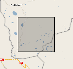
-67.7000,
-22.7000,
-66.7000,
-21.7500
BO, BOL, BOLIVIA [id=867000]
creation: 2023-05-26
2018-11-09
-
2022-11-22
vector
University of Bristol
Ignacio Castro Melgar
Wills Memorial Building,
Bristol,
BS8 1RJ
email:
not available
Role: originator
British Geological Survey
Enquiries
email:
not available
Role: distributor
British Geological Survey
Enquiries
email:
not available
Role: point of contact
Data Quality
GPS observations obtained from various sites. Description of sites; SEXP 2018: Receiver GR30 Antenna AS10 Ant. Height 0.66m UBAS 2018: Rec GR30 Ant AS10 Ant H. 0.66m JIMY 2018: Rec GR30 Ant AS10 Ant H. 0.66m DEMO 2018: Rec GR30 Ant AS10 Ant H. 0.243m UBQ4 2018: Rec GR30 Ant AS10 Ant H. 0.243m FOOF 2018: Rec-Ant THP Ant H. 0.66m MTLC 2018: Rec GR30 Ant AS10 Ant H. 0.66m LDZP 2018: Rec-Ant THP Ant H. 0.66m UBAS 2022: Receiver GR30 Antenna AS10 Ant Height 0.66m SEXP 2022: Rec GR30 Ant AS10 Ant H. 0.66m LDZP 2022: Rec-Ant THP Ant H. 0.66m FOOF 2022: Rec-Ant THP Ant H. 0.66m MTLC 2022: Rec GR30 Ant AS10 Ant H. 0.66m DEMO 2022: Rec-Ant THP Ant H. 0.06m JIMY 2022: Rec GR30 Ant AS10 Ant H. 0.66m NRVN 2022: Rec GR30 Ant AS10 Ant H. 0.66m OFSP 2022: Rec-Ant THP Ant H. 0.06m IGGY 2022: RecAnt THP Ant H. 0.66m
INSPIRE Implementing rules laying down technical arrangements for the interoperability and harmonisation of Geology
Commission Regulation (EU) No 1089/2010 of 23 November 2010 implementing Directive 2007/2/EC of the European Parliament and of the Council as regards interoperability of spatial data sets and services
Constraints
The copyright of materials derived from the British Geological Survey's work is vested in the Natural Environment Research Council [NERC]. No part of this work may be reproduced or transmitted in any form or by any means, or stored in a retrieval system of any nature, without the prior permission of the copyright holder, via the BGS Intellectual Property Rights Manager. Use by customers of information provided by the BGS, is at the customer's own risk. In view of the disparate sources of information at BGS's disposal, including such material donated to BGS, that BGS accepts in good faith as being accurate, the Natural Environment Research Council (NERC) gives no warranty, expressed or implied, as to the quality or accuracy of the information supplied, or to the information's suitability for any use. NERC/BGS accepts no liability whatever in respect of loss, damage, injury or other occurence however caused.
Either: (i) the dataset is made freely available, e.g. via the Internet, for a restricted category of use (e.g. educational use only); or (ii) the dataset has not been formally approved by BGS for access and use by external clients under licence, but its use may be permitted under alternative formal arrangements; or (iii) the dataset contains 3rd party data or information obtained by BGS under terms and conditions that must be consulted in order to determine the permitted usage of the dataset. Refer to the BGS staff member responsible for the creation of the dataset if further advice is required. He / she should be familiar with the composition of the dataset, particularly with regard to 3rd party IPR contained in it, and any resultant use restrictions. This staff member should revert to the IPR Section (ipr@bgs.ac.uk) for advice, should the position not be clear.
Metadata about metadata
00d68408-9de2-3e26-e063-0937940aff48
British Geological Survey
Environmental Science Centre,Keyworth,
NOTTINGHAM,
NG12 5GG,
United Kingdom
tel: +44 115 936 3100
email:
enquiries@bgs.ac.uk
Role: point of contact
2024-04-24